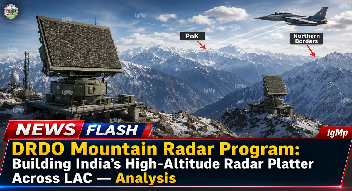
In March 2026, India’s Ministry of Defence signed a ₹1,950 crore contract with Bharat Electronics Limited (BEL) for two indigenous Mountain Radars designed and developed by the Electronics and Radar Development Establishment (LRDE) of the Defence Research and Development Organisation (DRDO). The systems, procured under the Buy (Indian-IDDM) category, include associated equipment and required infrastructure for the Indian Air Force (IAF). Their installation and commissioning are intended to strengthen India’s air-defence network while reducing dependence on foreign radar systems.
The larger significance, however, lies in what two radars could represent: the beginning of a more specialised high-altitude surveillance architecture designed around the unique problems of Himalayan warfare.
IgMp Strategic Takeaways
- Anchor Network: The ₹1,950 crore contract covers two Mountain Radars and associated infrastructure. It should be viewed as an initial capability investment rather than proof of a completed LAC-wide radar chain.
- Tech Ancestry: DRDO’s LRDE is responsible for the indigenous design and development, with BEL designated for manufacturing. Publicly available official information does not yet confirm that the contracted system is a direct Arudhra derivative or disclose its transmitter architecture.
- Tactical Objective: The strategic value of mountain-specific radar coverage is its potential to improve detection and tracking in terrain where conventional radar placement can be constrained by elevation, line-of-sight limitations and complex geography.
From Arudhra to Mountain Radar: The LRDE GaN Architecture
The Mountain Radar programme is best understood as part of India’s broader attempt to develop an indigenous radar ecosystem rather than as a standalone procurement.
LRDE has already established expertise in active electronically scanned array (AESA) radar development, while India’s defence electronics industry is progressively expanding domestic capabilities in advanced semiconductor technologies. That creates a plausible technological pathway for specialised mountain surveillance systems to benefit from newer solid-state radar components.
However, an important distinction is necessary. The Ministry of Defence’s March 31 announcement does not publicly identify the Mountain Radar as an Arudhra derivative, nor does it disclose a GaN-based transmitter architecture. Those descriptions should therefore be treated as open-source analysis or programme speculation until DRDO, BEL or the MoD provides technical confirmation.
The strategic logic behind such technology is nevertheless clear. A radar operating in demanding mountainous environments must deliver high availability, rapid target tracking and resistance to clutter while coping with difficult logistics and limited infrastructure. If future variants incorporate advanced GaN-based transmit/receive modules, the technology could potentially offer advantages in power density, efficiency and thermal management—but that remains an analytical possibility rather than a confirmed specification of the contracted system.
| Parameter | Conventional / Legacy Approach | DRDO Mountain Radar Programme |
|---|---|---|
| Developer / OEM | Mixed imported and legacy systems | DRDO-LRDE design; BEL manufacturing |
| Current confirmed procurement | Existing radar inventory | Two Mountain Radars |
| Contract value | — | Approximately ₹1,950 crore |
| Acquisition category | Varies by system | Buy (Indian-IDDM) |
| Primary operational challenge | General air surveillance | High-altitude and mountainous operating environment |
| Network role | Depends on individual system | Intended to strengthen IAF air-defence capability |
| Technical details | Often publicly documented | Detailed specifications not publicly disclosed |
Terrain Masking & Radar Shadows: Overcoming Tibetan Plateau Challenges
The most important battlefield problem in the Himalayas is not simply radar range. It is geometry.
A radar positioned behind a mountain ridge cannot reliably observe an aircraft or drone hidden by terrain. Likewise, an aircraft flying at low altitude can exploit valleys and terrain contours to remain below the radar’s effective line of sight. This creates what military analysts often describe as radar-shadow or terrain-masking problems.

That is why a dedicated Mountain Radar capability could provide more value than simply adding another conventional long-range sensor.
The objective would be to position sensors where their elevation and coverage complement existing surveillance assets, creating overlapping detection zones. The resulting network could improve the probability of detecting low-flying aircraft, helicopters, drones and cruise-missile-type threats approaching through difficult terrain.
The key word is network. A radar’s individual performance matters, but its real battlefield value increases when its tracks can be shared with command-and-control systems and other sensors. India’s Integrated Air Command and Control System (IACCS) is therefore central to the broader concept of a layered air-defence architecture.
Strategic Positioning: Why Gulmarg and Pfütsero Were Chosen
The proposed positioning of Mountain Radars at Gulmarg in Jammu & Kashmir and Pfütsero in Nagaland would, if confirmed, have an obvious strategic logic: one system would contribute to surveillance in the western Himalayan sector, while the other would address the eastern theatre.
But the exact deployment locations are not stated in the Ministry of Defence’s official March 31 announcement. Consequently, they should not yet be treated as confirmed procurement locations.
The broader strategic principle remains compelling. India faces two distinct high-altitude surveillance challenges across its northern and northeastern borders. The western sector demands persistent monitoring across the Ladakh and Jammu & Kashmir approaches, while the eastern sector presents dense terrain, narrow valleys and complex line-of-sight conditions.
A distributed radar network can help address both problems by reducing reliance on a small number of high-value sensors.

The “Radar Platter” Problem: Why China’s High-Altitude Network Matters
China’s military infrastructure across the Tibetan Plateau has increasingly emphasised persistent surveillance, communications and air-defence integration. India’s response cannot simply be to deploy more fighters. It must also build a sensor architecture capable of detecting threats early enough to support interception.
This is where the Mountain Radar programme becomes strategically significant.
Two radars will not transform India’s LAC surveillance picture. Their importance lies in demonstrating that India is investing in specialised indigenous sensors for terrain-specific warfare.
The next phase should therefore be judged by three metrics: how quickly the systems enter operational service, how effectively their tracks are fused into IACCS, and whether follow-on orders expand the capability into a genuinely distributed high-altitude surveillance grid.
For IgMp, the real information gain is this: the ₹1,950 crore contract is not merely another radar purchase. It is a potential building block in India’s transition from isolated radar deployments toward a more resilient, networked surveillance architecture tailored to Himalayan geography.
If India can combine these specialised sensors with airborne early-warning aircraft, space-based surveillance, passive sensors and existing ground-based radars, the result could be a much harder surveillance environment for low-flying and terrain-masked threats along the LAC.
The Mountain Radar programme, therefore, should be watched not for the headline number of two systems, but for what comes next: follow-on procurement, deployment density and network integration. Those three factors will determine whether the programme remains a limited niche capability—or becomes the foundation of India’s indigenous high-altitude radar grid.